Lubberland Creek Preserve: A Nature Conservancy Property That Gives a Glimpse into the World of Joseph Chesley
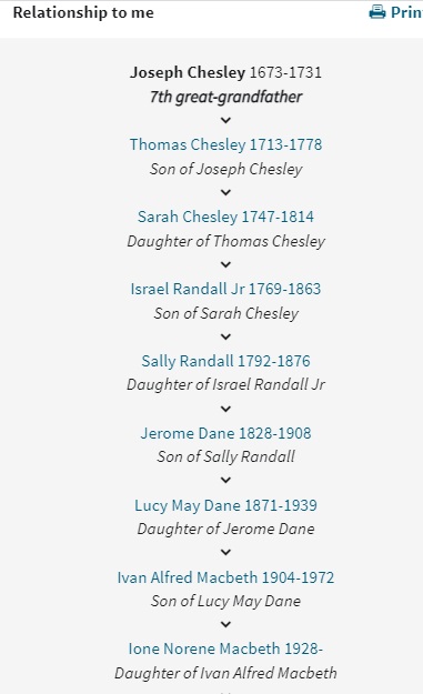
Joseph Chesley: 1673-1731
My seventh
great-grandfather Joseph Chesley had extensive land holdings in New Hampshire
in the early 18th century. These holdings included some marshlands
along the Great Bay, and two small islands known as Chesley’s Islands. Today,
the Nature Conservancy apparently owns some of that land. The property is
called the Lubberland Creek Preserve and is near the New Hampshire city of
Newmarket.
The land my
ancestor owned, including the islands, were originally owned by Richard York,
who conveyed it to his son John York in 1676. The tract was described as
follows:
“all that tract or point of land lying and being in
Lubberland, bounded by the Great Bay on the Southeast side, by the lands of
Nicholas Doe on the North West side, by the lands of the said John York on the
North east side, and by the creek called Goddards Creek on the South west
side…with a parcel of marsh on the South side and two little Islands containing
by estimation six acres be it more or less.”
John York sold the property to Roger
Rose in 1680. Rose sold it to John Rawlins of Newbury, and Rawlins sold it to
Joseph Chesley’s brother-in-law, John Smith, in July 1705. Improvements had
been made to the property by this point, which was now described as “a tract of
land and salt marsh, houses, fields and orchards scituate, lying and being in
Lubberland.”

The land then went to a neighbor,
Nicholas Doe, and his son Sampson sold the land and islands to Joseph Chesley
on March 27, 1707. According to the History of the Town of Durham cited below,
Joseph Chesley “is said to have had a garrison house here and the islands were
called Chesley’s Islands.”
A list of Piscataqua area historic
place names prepared by the Piscataqua Pioneers (cited below) provides
additional information about the locations of Lubberland, Goddard’s Creek, and
Chesley’s Islands. The descriptions below come from the Piscataqua Pioneers’
list:
Lubberland:
District on upper shore of Great Bay. Except for Goddard’s neck (in Newmarket)
the area was early part of Oyster River District of Dover. Since 1870 mostly in
Newmarket.
Chesley’s Islands. Two small islands in Great Bay off Lubberland Shore of Newmarket. Joseph Chesley Garrison was near here. Later known as Channel’s Islands.
Goddard’s Creek (Lubberland Creek). John Goddard, one of Mason’s carpenters of 1634 settled on theneck between the Creek and the mouth of Lamprey River. Goddard’s Creek until 1870 was a boundbetween Newmarket and Durham, the neck being part of Newmarket. In 1870 a large adjacent slice ofLubberland (Smith lands) was annexed to Newmarket.
So what has happened
to Joseph Chesley’s land? Amazingly, we can still visit this property, which
has been lovingly preserved and restored by the Nature Conservancy and is known
as the Lubberland Creek Preserve. So how do we know this is Chesley’s former
property? First, the preserve is located along Lubberland Creek, which, as we
learned above, used to be called Goddard’s Creek, which was the border of
Chesley’s property.

Secondly, the
Preserve’s brochure notes that the “Davis-Smith Garrison, which was built
somewhere on the present-day preserve, is remembered by a nearby stone marker
on Bay Road.” This may be the garrison mentioned in the Durham History property
description, which was called Chesley’s Garrison while he owned the property. If
not, the Chesley garrison was near Davis-Smith’s, as both were mentioned in the
same passage of the Durham History.

Lastly, the Preserve brochure states that “Robert Channell purchased this land around 1817 and passed it down through generations of the Channell family.” Chesley’s Islands were renamed Channell’s Islands, presumably when the property changed hands. We can assume the Channell family question was the Robert Channell family.
The preserve is
described as a “mosaic of estuarine, grassland, forest, and freshwater wetland
habitats, as well as relics of its agricultural past.” There are miles of
hiking paths through the various habitats. The restored marshes and estuaries
are close to the way the land would have appeared in Joseph Chesley’s time.
Someday I hope to visit the Preserve and look out over the same landscape that
my seventh-great-grandfather would have gazed upon.

Sources:
http://www.piscataquapioneers.org/pdf/piscataqua-area-place-names-and-history.pdf